Hiking : The Chambon volcano

Itinerary details
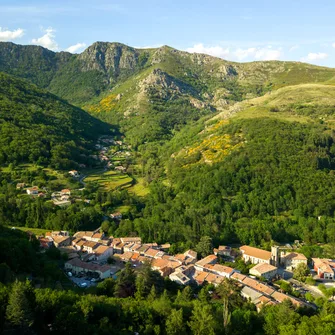
Follow the ancient routes that connect the Montpezat valley to the plateau by the Pal coast. On the way back, the Chambon volcano will reveal its characteristic shape and impressive emissions of mudslides, creating a unique panorama.
PR route marker: Yellow and white.
Must-sees along the route
Restaurant de l’Auberge de Montpezat
Restaurant


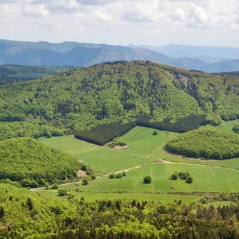
The Chambon’s maar
Free


The routes, descriptions, and GPS tracks provided on this website are strictly for informational purposes. Actual terrain conditions, official on-site signage, and municipal or prefectural orders always take precedence over digital data. Ardèche Tourisme accepts no liability in the event of accidents, getting lost, or unexpected route changes due to terrain hazards (weather events, flooding, landslides, forestry or agricultural operations, changes to private property boundaries, etc.). Hiking is undertaken entirely at the user's own risk. Users must objectively assess their physical fitness, use appropriate gear, strictly remain on marked trails to prevent soil erosion, and respect private property as well as guidelines relating to pastoralism (grazing herds and livestock guardian dogs).